Blečji Vrh
Appearance
Blečji Vrh | |
|---|---|
 | |
| Coordinates: 45°59′15.05″N 14°43′16.26″E / 45.9875139°N 14.7211833°E | |
| Country | |
| Traditional region | Lower Carniola |
| Statistical region | Central Slovenia |
| Municipality | Grosuplje |
| Area | |
| • Total | 2.54 km2 (0.98 sq mi) |
| Elevation | 547.5 m (1,796.3 ft) |
| Population (2002) | |
| • Total | 50 |
| [1] | |
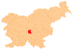
Blečji Vrh (pronounced [ˈbleːtʃji ˈʋəɾx]; in older sources also Bleč Vrh,[2] German: Feldsberg[2]) is a settlement in the Municipality of Grosuplje in central Slovenia. The area is part of the historical region of Lower Carniola. The municipality is now included in the Central Slovenia Statistical Region.[3]
Name
[edit]Blečji Vrh was attested in written sources as Welze in 1145 and Weltsperg in 1505.[4]
Church
[edit]The local church is dedicated to Saint Benedict and belongs to the Parish of Polica. It is a 13th-century Romanesque building that was expanded in the 18th and 19th centuries.[5]
References
[edit]- ^ Statistical Office of the Republic of Slovenia
- ^ a b Leksikon občin kraljestev in dežel zastopanih v državnem zboru, vol. 6: Kranjsko. Vienna: C. Kr. Dvorna in Državna Tiskarna. 1906. p. 100.
- ^ Grosuplje municipal site
- ^ "Blečji Vrh". Slovenska historična topografija. ZRC SAZU Zgodovinski inštitut Milka Kosa. Retrieved February 15, 2021.
- ^ "EŠD 2137". Registry of Immovable Cultural Heritage (in Slovenian). Ministry of Culture of the Republic of Slovenia. Archived from the original on 7 May 2012. Retrieved 28 June 2011.
External links
[edit] Media related to Blečji Vrh at Wikimedia Commons
- Blečji Vrh on Geopedia


